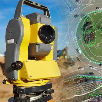
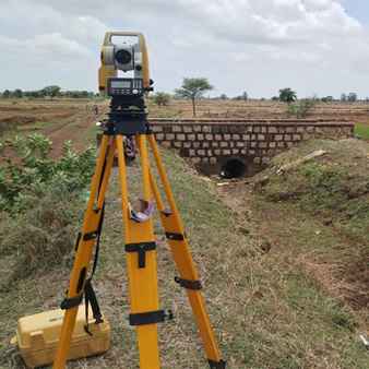
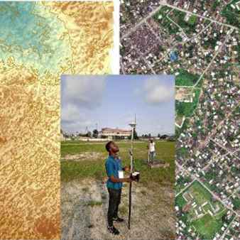
Mape IT Solutions is a nationwide DGPS / Total Station technology company who offers end-to-end industrial UAV solutions to both public and private sector across the globe. We are using latest surveying techniques for making ground corrections. This includes taking highly specialized services of Differential Global Positioning System (DGPS). We have adequate infrastructure and equipments like Global Positioning System (Garmin) and Total Survey Stations (Topcon & Geodimeter).
We utilise Differential Global Positioning System (DGPS) to
establish GPS control points based on WGS-84 co-ordinate system. Further,
Total Station traverse control is carried out between DGPS co-ordinates, to
establish co-ordinates of all turning points, intermediate points and the flag
control points, so that all co-ordinates are in terms of WGS-84 coordinate
system.
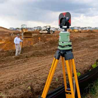
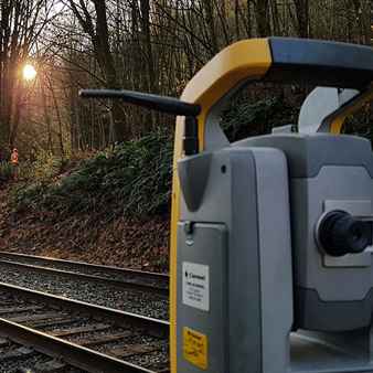
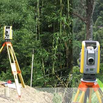
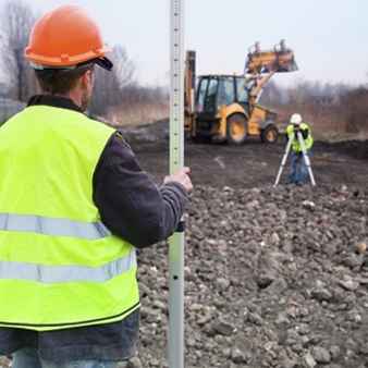
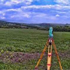
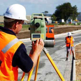
We deploy Total Station for all survey measurements, readings required
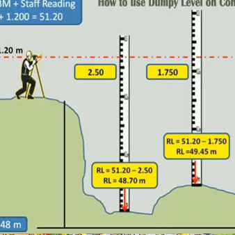
for planimetry, information and feature capturing, and levels. All level shall be
with respect to Mean Sea Level. The system shall be capable of integrating with
advanced computer software for data capturing, down loading and preparation of
engineering drawings and alignment sheets. With the data captured, it should be
feasible to create a Digitised Terrain Model through the use of engineering
software.
Our staff has many years of Geologists & Surveyors experience in the any kind of surveying field, and is dedicated to providing our clients with quality surveys and survey services. In addition to our own extensive records.
How does DGPS work?
1
A Differential Global Positioning System (DGPS) is an upgrade of the Global Positioning System (GPS). It provided improved location accuracy from about 15 meters to a few centimeters.
2
Each DGPS uses a network of fixed ground-based reference stations to broadcast the difference between the positions indicated by the GPS satellite system and known fixed positions.
3
These stations broadcast the difference between the measured satellite pseudo ranges and actual (internally computed) pseudo ranges, and receiver stations may correct their pseudo ranges by the same amount.
4
The digital correction signal is typically broadcast locally over ground-based transmitters of shorter range.
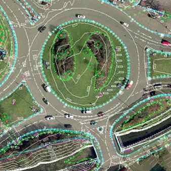
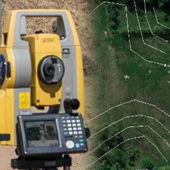
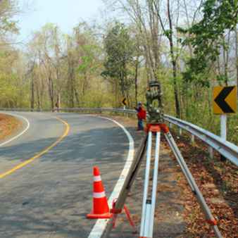
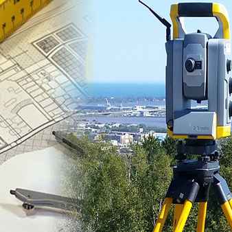
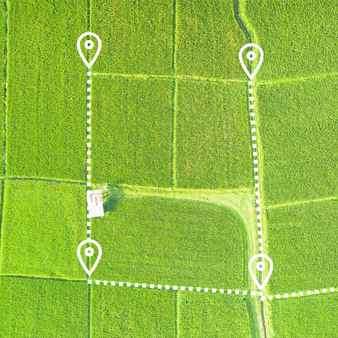
The purpose of a Topographical survey is to gather survey data about the natural and man-made features of the land, as well as its elevations. From this information a three-dimensional map may be prepared. You may prepare the topographic map in the office after collecting the field data by GPS or Total Station.
Topographic Surveys are used to identify and map the contours of the ground and existing features on the surface of the earth or slightly above or below the earth's surface (i.e. trees, buildings, streets, walkways, manholes, utility poles, retaining walls, etc.).
If the purpose of the survey is to serve as a base map for the design of a residence or building of some type, or design a road or driveway, it may be necessary to show perimeter boundary lines and the lines of easements on or crossing the property being surveyed, in order for a designer to accurately show zoning and other agency required setbacks.
- Road or bridge design or improvements
- Grading or drainage projects.
- New construction.
- Remodeling projects to existing structures.
- Utility design.
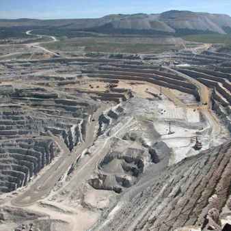
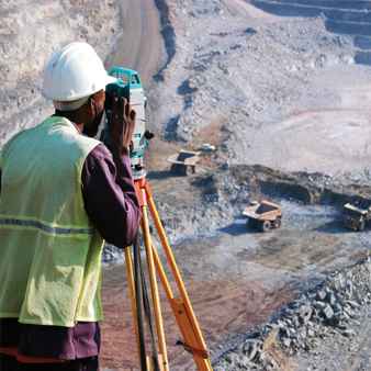
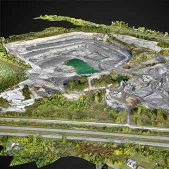
Mining surveyors are a type of surveyor or mapping scientist that use all the tools, technologies and methods at the disposal of the discipline to record details for mines. Mine Surveying is a branch of mining science and technology. It includes all measurements, calculations and mapping which serve the purpose of ascertaining and documenting information at all stages from prospecting to exploitation and utilizing mineral deposits both by surface and underground working.
- The location, structure, configuration, dimensions and characteristics of the mineral deposits and of the adjoining rocks and overlying strata. The assessment of mineral reserves and the economics of their exploitation.
- The acquisition, sale, lease and management of mineral properties.
- Providing the basis for the planning, direction and control of mine workings to ensure economical and safe mining operations.
- The study of rock and ground movements caused by mining operations, their prediction, and the precautions and remedial treatment of subsidence damage.
- Assisting in planning and rehabilitation of land affected by mineral operations and collaborating with local government planning authorities.
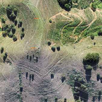
We have extensive business experience matching up to the criteria of precisely doing contour surveys for our clients. One of the well-known service providers of contour survey services created in accordance with global quality standards is us. Our clients receive our services at reasonable costs. They can be created to order and tailored based on the client's demands.
Contour surveys are a basic prerequisite for building and land development. In most cases, the purpose of detail surveys is to indicate features on, and adjacent to, a property. There are a number of site features and levels required by architects and planners. A topographic survey is a vital component of a successful development application for any development of your land. We can undertake topographic surveys using a range of technologies, from remote access reflectorless Total Stations and 3D scanners (where there may be restricted access) to GPS technology (large scale topographic surveys).
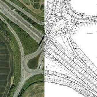
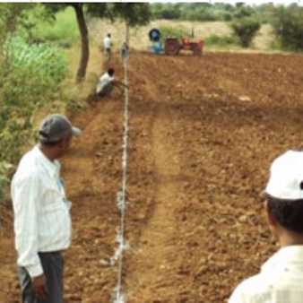
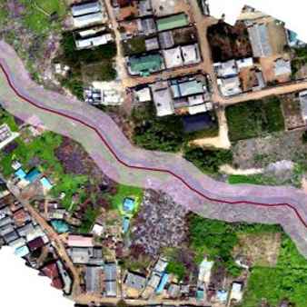
We are a prominent organization, which is engaged in rendering Route Survey Services to respectable clients. These route survey services rendered by us possess four modes of working. The four steps are reconnaissance & planning, works design, right of way acquisition and construction of works. Offered services are applicable for making number of highways, canals, pipelines and rail roads.
In order to design and build a variety of engineering projects, including roads, railroads, pipelines, and utilities, it is important to calculate alignment, grading, and earthwork quantities. Your choice of land surveying businesses is important when accuracy counts. Whether your project is 2 miles long or 20 miles long, public or private, you can rely on the qualified land surveyors at MIS to give you the most accurate route surveys. The land surveying experts at MIS are precise, dependable, and cost-effective because to their many years of experience in the field.
Experts For Land Surveys Are Available At Our Mape IT Solutions Company. Also, field crews for land surveys have years of expertise doing field surveys and mapping on various kinds of properties in support of building and development.
The scientific process of measuring a specific portion of the earth's surface's dimensions, including its horizontal distances, directions, angles, and elevations, is known as a land survey, or simply a survey. On a survey, artificial structures like a road or a building may also be identified.
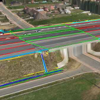
We are a well-known provider of road surveying services, and our experts have years of experience in the field. Our services also meet strict international quality standards. We have played a key role in carrying out road, rail, and canal route surveys that help to identify the position of any potentially hazardous voids and the state of the pavement's sublayers.
Roads can be surveyed to identify any potentially hazardous voids and the state of the sub layers beneath the pavement. During these surveys, utility mapping can also be produced to precisely map the location and depth of all utilities, including PVC and fibre optic. As these road inspections can be completed very quickly, there is no need to close any roads. After thorough and knowledgeable analysis of the gathered data, detailed reports are produced and can be given in print copy or CD format.
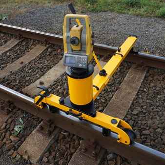
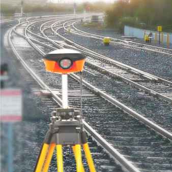
We are widely known in the industry for successfully providing our clients with service support for conducting railway surveys. In the field of railway engineering works, these surveys are employed in a variety of applications.
Here, we specialise in using cutting-edge process technology and contemporary tools to help us give high-quality services to our clients. In addition, we make sure that services are provided in accordance with the precise requirements of our clients.
Providing and managing the spatial data necessary for the design and upkeep of railroad infrastructure is the major goal of railway surveying. For tracks and related infrastructure to be designed, built, and maintained so that trains can operate through the system safely and at the fastest possible speed, rigorous surveying procedures, technical standards, and design principles must be used.
Transmission line alignment and ground profile are determined through transmission line surveys, which are then used to create a schedule for tower spotting. For the wire to be stinged, a Suitable profile drawing must be prepared. An entire answer to such needs is offered by Mape IT Solutions.
In order to complete the irrigation project, we must be able to give precise irrigation survey services. For use in both static and real-time situations, we employ Trimble GPS equipment.
For the management of disasters like floodplains, we have also produced a survey. Up until the tendering stage, we support the client all the way through. Our technical specialists assist clients with survey analysis, layout design, earthwork design, plan preparation, and specification of the tendering process.
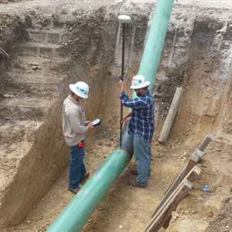
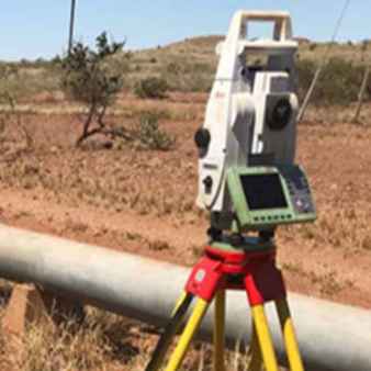
Mape IT Solutions has extensive experience surveying oil and gas pipelines. Whether it is a small project or a project that will require multiple phases and multiple years, we has the equipment, the knowledge, and the experience to manage any pipeline survey with our Professionals. We has performed pipeline construction surveys including construction staking and as-built surveys. In addition, we has managed many rights of way and easement surveys for a number of pipeline companies in India. When locating existing pipelines, our Professional uses the most efficient technique to locate the pipeline.
Pipeline surveyors are regarded for their ability to collect high-quality data on oil, gas, and water projects in a safe manner, including pre- and post-construction surveys as well as complex midstream and long-haul surveys as well as simple upstream pipeline tasks. Our committed field crews and nationally licenced professional pipeline surveyors take satisfaction in knowing the business and applying their knowledge, expertise, and technology to assist our clients in achieving their objective of timely product delivery.
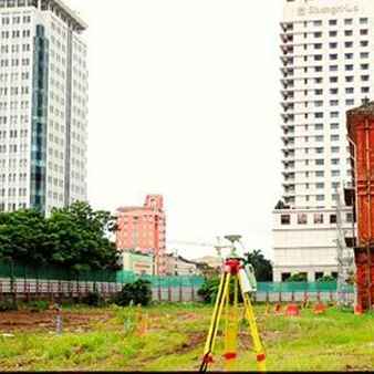
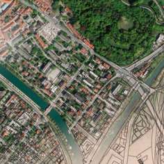
We offer our clients City Survey services, which mostly serve highway engineers. With regard to high point density highway surveying, we provide our services by gathering the necessary data with the aid of our highly qualified engineers and specialists. The data that we gather is supplied as a CAD file or hard copy and is readily transferred to our programme for design purposes. in order to satisfy the many different needs of our clients.
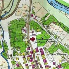
Cadastral surveys are specially designed large scale surveys, generally on 1:4000 scale which are linked to land ownership and property. In case of urban cadastral surveys, the scales may be as large as 1:500 to 1:4000. This paper is, however, emphasizing the rural and village properties. The urban cadastre, although very vital needs a separate and detailed discussion.
We have a staff that is committed to cadastral survey. A complete record of information on a location's property is kept in a cadastral map. The exact location, dimensions, and other geographic divisions of the properties or specific land plots are included in this information. Cadastral mapping services enable the creation of maps that aid in the efficient maintenance of public land records.
Cadastral mapping services can be used by businesses, design and engineering firms, real estate developers, and governments at the federal, state, and local levels to help them make informed decisions. Users of cadastral mapping services can search for additional information such as survey district names, distinct parcel numbers, the locations of existing structures, street names, border measurements, and references to prior maps.
To support structure where gradual height adjustment is needed, the pivot foot has a small swiveling angle to fit slightly uneven floor. The connection between the pivot base and the spindle can be released with a tool. For this Leveling Survey services we provide.
To support structure where gradual height adjustment is needed, the pivot foot has a small swiveling angle to fit slightly uneven floor. The connection between the pivot base and the spindle can be released with a tool. For this Leveling Survey services we provide.