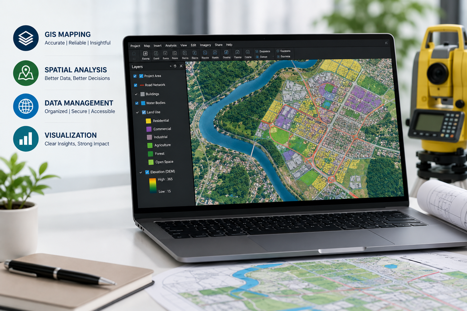
Government infrastructure and development projects require accurate spatial data, efficient planning, and reliable decision-making systems. From smart city initiatives to transportation networks and utility management, Geographic Information System (GIS) technology has become an essential part of modern governance. MAPe IT Solutions provides professional GIS Mapping Services in India, supporting government departments, public sector organisations, engineering consultants, and infrastructure companies with accurate geospatial solutions tailored for large-scale projects.
With years of industry experience in geospatial technology, remote sensing, drone surveying, and digital mapping, MAPe IT Solutions has established itself as a trusted GIS company in India. The company combines technical expertise, modern surveying technologies, and industry best practices to deliver high-quality GIS mapping solutions for complex government requirements.
Importance of GIS Mapping in Government Projects
GIS mapping plays a critical role in planning, monitoring, and managing government infrastructure projects. It helps authorities visualise spatial data, improve resource allocation, monitor assets, and make informed decisions based on accurate geographic information.
Government agencies across India are increasingly adopting GIS technology for:
- Smart city planning
- Road and highway development
- Railway corridor mapping
- Urban infrastructure management
- Water supply and drainage systems
- Land record digitisation
- Environmental monitoring
- Disaster management
- Utility mapping
- Forest and agricultural surveys
GIS mapping improves operational efficiency while reducing project delays and planning errors. Accurate geospatial data enables government organisations to make strategic decisions with confidence.
Why GIS Mapping Services are Essential in India
India's rapid urbanisation and infrastructure growth have increased the demand for reliable geospatial solutions. Government projects often involve large geographical areas, multiple stakeholders, and complex datasets. Traditional mapping methods may not provide the speed and accuracy required for modern infrastructure planning.
Professional GIS Mapping Services in India help government agencies by:
Improving Data Accuracy
GIS technology provides highly accurate spatial information that supports engineering, planning, and asset management activities. Accurate data minimises project risks and improves execution quality.
Supporting Smart Infrastructure Development
Smart cities require integrated spatial databases for traffic management, utility planning, environmental monitoring, and public service delivery. GIS mapping creates a strong digital foundation for smart governance.
Enhancing Decision-Making
Government departments can visualise real-time geographic data, identify project challenges, and plan development activities more effectively.
Reducing Project Costs
Accurate GIS data reduces survey errors, avoids duplication of work, and improves resource utilisation across projects.
Enabling Better Asset Management
GIS platforms help authorities monitor roads, pipelines, drainage systems, electrical networks, and public infrastructure efficiently.
GIS Mapping Applications for Government Projects
GIS mapping technology is widely used across various government sectors in India.
Urban Planning and Smart Cities
GIS helps urban development authorities analyse land use patterns, zoning regulations, population density, and infrastructure requirements. Smart city projects rely heavily on GIS databases for planning and implementation.
Transportation and Highway Projects
Government highway and railway projects use GIS mapping for route planning, corridor analysis, terrain assessment, and land acquisition management.
There are also opportunities to integrate GIS data with services such as LiDAR mapping, drone surveys, and topographic surveys for improved infrastructure planning.
Utility and Infrastructure Mapping
GIS mapping supports utility management by accurately locating underground pipelines, drainage systems, electrical lines, and communication networks.
Disaster Management and Environmental Monitoring
Government agencies use GIS systems for flood analysis, drought assessment, environmental impact studies, and emergency response planning.
Land Record Management
Digitisation of land records using GIS technology helps improve transparency, reduce disputes, and simplify administrative processes.
Expertise and Technology Used by MAPe IT Solutions
Mape IT Solutions combines technical expertise with advanced geospatial technologies to deliver reliable GIS mapping solutions for government projects in India.
The company's experienced GIS professionals, survey engineers, CAD specialists, and remote sensing experts work closely with clients to understand project objectives and deliver customised solutions.
Advanced GIS Technologies
MAPe IT Solutions uses industry-standard GIS software and modern surveying equipment to ensure precision and efficiency across projects.
Services include:
- GIS database creation
- Spatial data analysis
- Utility mapping
- Land base mapping
- Digital cartography
- Satellite image processing
- Orthophoto generation
- Remote sensing analysis
The company also integrates GIS workflows with drone survey services, CAD drafting, DGPS surveys, and BIM solutions to provide complete geospatial support for infrastructure projects.
Why Government Agencies Choose MAPe IT Solutions
Government projects require reliability, technical competence, and proven industry experience. MAPe IT Solutions focuses on delivering accurate geospatial data with a strong commitment to quality and timely execution.
- Industry Experience: The company has experience supporting infrastructure, engineering, utility, and mapping projects across multiple sectors.
- Skilled Technical Team: The GIS specialists and survey professionals at MAPe IT Solutions follow industry standards and best practices to ensure data quality and project accuracy.
- High-Accuracy Deliverables: Using advanced GIS software, drone technologies, and modern survey methods ensures dependable results for government applications.
- Scalable Solutions: Whether it is a small municipal project or a large-scale infrastructure development programme, MAPe IT Solutions can deliver scalable GIS solutions tailored to project requirements.
Need Professional GIS Mapping Services for Government Projects?
Accurate spatial data is essential for successful infrastructure planning and smart governance. Partner with experienced GIS professionals for reliable and cost-effective geospatial solutions.
Call Now: +91 9443338087
Email: info@mapeitsolutions.com
Future of GIS Mapping in India
The future of GIS technology in India is closely connected with digital transformation and smart infrastructure development. Government initiatives such as Smart Cities Mission, Digital India, and infrastructure modernisation programmes continue to increase the demand for advanced GIS mapping services.
Emerging technologies including artificial intelligence, drone mapping, LiDAR surveys, and cloud-based GIS platforms are transforming how spatial data is collected and analysed.
As infrastructure projects become more data-driven, GIS mapping will remain a critical technology for efficient planning, monitoring, and sustainable development.
Organisations that invest in accurate geospatial solutions today will benefit from improved project execution, reduced operational costs, and better decision-making capabilities in the future.
GIS mapping has become an indispensable tool for government projects in India. From urban planning and infrastructure development to utility management and environmental monitoring, GIS technology helps authorities improve efficiency, accuracy, and project outcomes.
MAPe IT Solutions delivers professional GIS Mapping Services in India with a strong focus on quality, precision, and technical excellence. By combining industry expertise, advanced technologies, and customised geospatial solutions, the company supports government agencies and infrastructure organisations in achieving successful project execution.
For reliable GIS mapping, drone surveys, LiDAR mapping, utility mapping, and geospatial services in India, connect with MAPe IT Solutions today.
Frequently Asked Questions
1. What are GIS Mapping Services?
GIS Mapping Services involve collecting, analysing, and managing geographic data to support planning, infrastructure development, and decision-making processes.
2. How are GIS services used in government projects?
Government departments use GIS for urban planning, highway projects, utility management, disaster management, land records, and environmental monitoring.
3. Why is GIS important for smart city projects?
GIS helps integrate spatial data for traffic systems, utilities, land use planning, and public infrastructure management, making smart city operations more efficient.
4. Does MAPe IT Solutions provide GIS Mapping Services across India?
Yes, MAPe IT Solutions provides GIS Mapping Services for government and infrastructure projects across India.
5. What other geospatial services does MAPe IT Solutions offer?
The company also provides LiDAR mapping, drone survey services, CAD drafting, DGPS surveys, photogrammetry, BIM services, and utility mapping solutions.